
Every year three of my friends—Eric, Dave, Jim—and I take a week-long bicycle trip, with all our clothes for the week and camping equipment carried in bike bags attached to our bikes, somewhere in the country. I should make clear here that we are not fitness freaks training for the Olympics. We are all 50-plus-year-olds and in normal physical condition. We ride for the exercise, camaraderie, and scenery, and enjoy meeting the various people into whom we happen to bump (not literally) throughout the ride.
We have ridden from our hometown of St. Paul, MN to Dubuque, IA and, the following year, from Dubuque, IA to St. Louis, MO (we were toying with the idea of riding the width of the country one year at a time), both of which rides were along the Great River Road, a beautiful route along the Mississippi River.
One year we rode the Upper Peninsula of Michigan and, another, the George Mickelson Bike Trail, a 110-mile long trail through the Black Hills of South Dakota. We have been doing this for twelve years now and usually ride between 300 and 500 miles in the week, depending on terrain (very hilly, or relatively flat) or riding surface (asphalt or gravel).
We try to stay on lightly traveled country roads or bike trails because, when we plan our trip on roads, we invariably end up on a major highway battling heavy traffic while trying to connect to another, less traveled, road. This can make for some very unpleasant cycling, especially if the road in question does not have a decent riding shoulder (Dave swears that on one such road, two years ago, a semi-truck came close enough to “click” the mirror on his bike). We obviously don’t enjoy that kind of riding for our own sake, but we don’t like to cause problems for vehicle traffic either.
A bike trail is the obvious answer, but, since riding a 10-mile trail thirty times would be somewhat boring (OK, very boring), and as riding several smaller trails is not feasible, as these trails are usually connected to each other by roads with names like “Through Highway 77 for Very Large Trucks with Unstable and Leaky Loads,” we look for long bike trails. And the trail has to be within driving distance to St. Paul, MN because we have to drive our bikes to the trails since one of our members, who I hesitate to name (Dave—hey, I hesitated!), is too cheap to fly. With all this taken into account, the KATY Trail, a 225-mile-long bicycle trail through the heart of Missouri (and within driving distance), was very attractive.
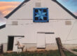
So, early in October, we drove to Hermann, MO, a pretty German town on the Missouri River, and spent the night at the very nice Hermann Motel (112 E. 10th, Hermann, MO 65041; phone: 573-486-3131) whose owners were kind enough to let us leave our vehicle in their parking lot for the week.
The next day we started for the Katy Trail’s eastern trail head in St. Charles as we intended to ride the trail both ways (we later abandoned that idea in favor of getting a lift to the western end of the trail and riding back, allowing us to ride fewer miles each day and have more time to enjoy the towns through which we passed).
We encountered our first obstacle less than a mile down the road when we got to the Hermann bridge, a narrow, two-lane structure with no shoulder. We had to “take the lane” (riding two abreast using the entire lane so a motor vehicle does not try to squeeze past, thus squeezing us against the guard rail) and ride as fast as we could so as not to hold up traffic longer than necessary. We had to cross the bridge three times on the ride and each time a vehicle—twice a car and once a school bus) came up behind us, slowed, put its emergency flasher on, and patiently followed us to the other side—Thank You! Two miles later we entered the KATY at McKittrick and were on our way.
The trail is crushed, packed limestone, which makes for a fairly smooth ride, and on the eastern end winds its way through shaded woodlands, farmland areas with sweeping views of the river valley, and the spectacular Bernheimer Bluffs near, well, Bernheimer (thus the name). Between Treloar and Peers Jim, who had two bike bags of clothing attached to his front fork making the bike less stable (actually, Jim’s riding style makes the bike less stable, but that’s another story), was surprised by a deep rut in the middle of the trail that grabbed his front wheel and tipped him over. He managed to do a nice “tuck and roll” and rolled into the woods looking like a pumpkin rolling off a hay wagon. Other than scrapes and bruises Jim was alright and we continued the ride keeping our eyes peeled for any more ruts (we found no more).
At Marthasville we stopped for lunch and found a very nice buffet and great, friendly service at Loretta’s Place restaurant (636-433-5775). On our way again we made a short detour between Marthasville and Dutzow to ride to the Daniel Boone grave site where, legend has it, Boone and several family members may be buried (or maybe not). We made two more stops—at the Augusta Brewing Company (a small bar situated on a hill alongside the trail with one of those aforementioned sweeping views of the river valley) and Defiance, a small town with several businesses geared to the cyclists’ needs and interests, and arrived in St. Charles with enough time to enjoy the beautiful riverside park at the trail head. We spent the evening touring Historic St. Charles and having a fine dinner at the Trail Head Brewing Company at the corner of Boone’s Lick and Main (636-946-2739)
I should mention that on this section of the trail we found several somewhat dangerous crossings where the road to be crossed can not be seen well from the trails so that, even when a cyclist stops and looks, a car may appear quickly before the cyclist can get back up to speed and get across the road. Or, in some cases, the road to be crossed parallels the trail, then cuts sharply across the trail, making it difficult to look for vehicles on the road behind you without turning almost all the way around. Be careful out there and tell your children to stop before the crossings and wait for you.
The next day we rode back to Hermann, this time stopping to make the 1,000-foot walk from the trail to the Blumenhof Winery (P.O. Box 30, Dutzow, MO, phone 636-433-2245), and it was well worth the hike (one can tell that the bike riding is only part of our enjoyment). We tasted several different wines, including a delicious red that had a strong hint of oak, and bought two cases to be sent home (they were waiting for us in Minnesota upon our return). Along the route we passed a maintenance crew cutting brush away from the trail and we noticed that some of the branches left on the trail had small thorns on them. We avoided the branches as best we could and were thankful we didn’t pick up a thorn in one of our tires (this will come up again later). Back in Hermann that night we had a wonderful dinner at the Stone Hill Winery and Restaurant (1110 Stone Hill Highway, Hermann, MO, 65041; phone 573-486-3479), a winery built on a hill with a beautiful view of the town.
After dinner we contacted Creason’s KATY Trail Shuttle (573-694-2027) and were met the next day by Gary Creason (owner, driver, and vice-president in charge of information) who fit all our bikes, gear, and us in or on (two of the bikes were on, we were in) his van and drove us to Clinton, all the while keeping up a running commentary about points of interest along the trail. Gary was a wealth of area knowledge and the only man I know who can drive, drink a cola, pass out brochures, and point out the window at the same time!
When we left Clinton, after a quick tour of the city by Gary, at noon, the temperature was 90 degrees, which was a shock to our systems (it had been 40 degrees when we left Minnesota). By the time we got to Windsor we were ready to cool off and, as luck would have it, a sign on the trail pointed us to what has to be the world’s smallest Dairy Queen several blocks away at which we each had a delicious (and cold) peach shake.
About six miles north of Windsor we rode through the Highpoint Prairie restoration area, a beautiful example of what the landscape was like before housing developments, highways, businesses and bike trails. We spent the night at the Bothwell Hotel (103 E. 4th Street, Sedalia, MO 65301; phone 660-826-5588) in Sedalia and had a nice dinner at D’Amici’s Restaurant in the hotel (I have never lost weight on one of our rides, despite the energy output), then just walked around town looking at the architecture of the older buildings and ended up in the town library sitting in overstuffed chairs reading the local newspapers.
The next day we were on the trail early after our Continental breakfast at the Bothwell and had a pleasant half-day of riding, stopping in Pilot Grove for freshly-made sandwiches bought at a Gerke’s Grocery, located across the street from the trail. As we ate lunch, however, the wind picked up, clouds rolled in, and we heard thunder in the distance (ahead of us, unfortunately). Being made of fairly sturdy stock (and having no real alternative) we set out hoping to dodge the predicted “scattered thunderstorms.” No luck! About five miles north a “scattered thunderstorm” found us and poured on us for a half-hour while we pedaled stoically ahead, searching for a large culvert (which had been abundant while it was bright and sunny) in which to wait out the storm. No luck!
I’ve found cycling to be a good life lesson—the good times will be interspersed with bad times—and this was definitely one of the bad times. We were wet, muddy, generally uncomfortable, and concerned that, at any moment, the heavens would unleash a bolt of lightening, numerous examples of which we could see in the not distant enough distance, in our direction. After thirty minutes or so of riding through the driving rain we finally found that culvert—five minutes after the sun broke out. We finished the day in a light drizzle to Boonesville and headed for a hotel the folks at the Boonesville trail had helped us locate and contact. The tough part wasn’t over, however, as the highway from the trail head to the hotel area of town was narrow, busy, and uphill. It would have been a real help if there had been a spur trail (or just a dirt path) from the KATY to the hotel area, especially as the KATY comes fairly close to the area at one point. At any rate we got to the motel, hosed off the bikes, and washed and dried our clothes in preparation for the next day’s ride.
The next day we left Boonesville under cloudy but dry skies and, after crossing the Missouri River at the Highway bridge (which had a nice, wide shoulder), stopped to see the old KATY Roundhouse site just north of town. An hour or so farther along the trail we came upon a fifty-yard stretch of mud caused, no doubt, by the previous day’s thunderstorm, that was so thick we had to walk the bikes through and then clean the mud, which had caked so thickly onto our tires that we could no longer clear the fenders, from our tires.
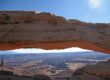
That obstacle overcome, we continued the ride and between New Franklin and Rocheport rode past one of the trail’s “sights,” Pearson’s clay tile elevator. North of Boonesville the trail turns back to the southeast and enters probably the most spectacular portion of the route, traversing river bluffs country with bluffs on one side and the Missouri River on the other. We rode through the 243-foot-long stone arched Rocheport Tunnel and enjoyed a nice lunch at the Trailside Cafe and Bike Rental (First and Pike; phone 573-698-2702) in Rocheport.
We finished the day off by riding to Hartsburg, stopping to see Pierced Rock Natural Bridge, Lewis & Clark Cave and the pictographs above the entrance, and passing the spur trail to Columbia (a nine-mile trail making the KATY easily accessible to Columbia). We spent the night at the Globe Hotel Bed and Breakfast (a turn-of-the-century hotel, P.O. Box 89, Hartsburg, MO 65039; phone 573-657-4529). The proprietor, Jeanette Crawford, made us feel welcome and, despite having temporarily lost the use of one hand due to a self-inflicted injury she sustained while working on the restoration of one of the doors, prepared a wonderful breakfast for us and four other cyclists the next morning. The other cyclists were a young couple from Ohio who return every year to ride the KATY and two men from California who, as we do, ride a different area of the country every year.
Our last day of riding took us east past Jefferson City where we got a nice view of the capitol building from across the river. We would have liked to see the city itself but the only access was across the very busy Highway 54 bridge, that did not look the least bit “bicycle friendly” (there are, however, several hotels that will send a shuttle across to give a lift to anyone planning on staying the night at their hotel).
We rode past Standing Rock (a huge oblong-shaped boulder standing on one end) just east of Steedman, and more beautiful bluffs, and ended the day and the ride back to Hermann, having an end-of-the-ride dinner at the Wild Grapevine Restaurant (4th and Market; phone 573-486-8463).
The Katy has given us a great ride, a relatively good surface (excluding one rut and one mud hole), good food stops, nice scenery, nice people, and had only made us pay for it with one thunderstorm (yeah, OK, and a mud hole and a rut). I encourage anyone to try the KATY, be it for a week, a day, or several hours.
We are back home in Minnesota now (10 degrees below zero) being warmed by our memories of the ride—and a case of Missouri wine.
FOOTNOTE:
A couple of days after returning home I rode my bike (now unencumbered by the bike bags) to work and got a flat tire (a slow leak). I fixed the flat and rode home only to find the tire flat again the next day. This time I looked for something on the rim that might be causing the slow leak and found nothing. I fixed the tire, rode to work and, once again, upon returning to the bike at the end of the day, found the tire flat. This time I studied the tire itself for a cause and found one last souvenir of Missouri—a thorn was embedded in the tire just far enough that it would not cause a flat until ridden over for some time. As I had not seen a thorn bush since the KATY, I surmised the thorn was from one of the bushes thrown onto the KATY by the trimming crew.
Thanks, but, next time, just send a postcard!
Bruce Wynkoop
For more information about the KATY Trail call the DNR at 1-800-334-6946.


The Daniel Boone gravesite was an interesting stop not only for its lack of a body (it had been spirited away to the Bluegrass State capital by Kentuckians whose appreciation of Boone was greater with him dead than alive) but also for the persimmon tree growing there. Not having tasted one before, we eschewed the dropped fruit in favor of ones still hanging on the tree. The expression “Pucker up” may have been invented for such an occasion, the astringent fruit drying the mouth and seeming much less ripe than its appearance indicated. We were surprised that such an attractive fruit, in size and appearance resembling an apricot, could be so unpleasant until we sampled one of the drops and were surprised to find it sweet and juicy, purged of astringency by extended ripening. Some things are worth a second try.